Tag Archives: New Orleans history

Vallette Street

The Gist: Vallette Street in New Orleans is named after Francois Valette, an entrepreneur that owned several docks and warehouses in Algiers Point on the West Bank of the Mississippi River. His son, Octave, changed the spelling of the family name.

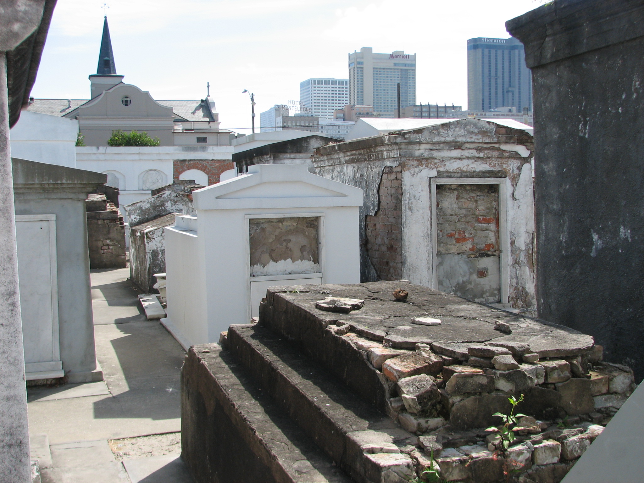
Yesterday:  Algiers Point dates back to the finding of New Orleans and had also been referred to as Point Antoine, Point Marigny, and Slaughter House Point over the centuries. The original land (now known as Algiers) was granted to Bienville and established in 1719. Its official name became Duverjeville upon the American annexation of Louisiana, and it would not be officially known as Algiers until 1840. Chase says, “One of the earliest appearances in print of its name as Algiers is the New Orleans City Directory of 1840. Thirty years later, on March 14, 1870, when the community was formally incorporated into the city of New Orleans, it knew no other name.” (185-86).

However, the area had been commonly called “Algiers Point” long before the name became official. Given the fact that it once was a prominent slave trade depot, the large presence of African slaves gave off the impression of it being like Africa itself. Algiers is the capital city of Algeria, and there is a legend that General “Bloody” O’Reilly suggested the name after recently fighting Algerian pirates in Mediterranean Sea.

vallette street home

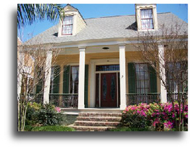
This historic house along Vallette Street was built for Francois Valette’s sister, Josephine, and her husband in 1848. Credit: algierspoint.org

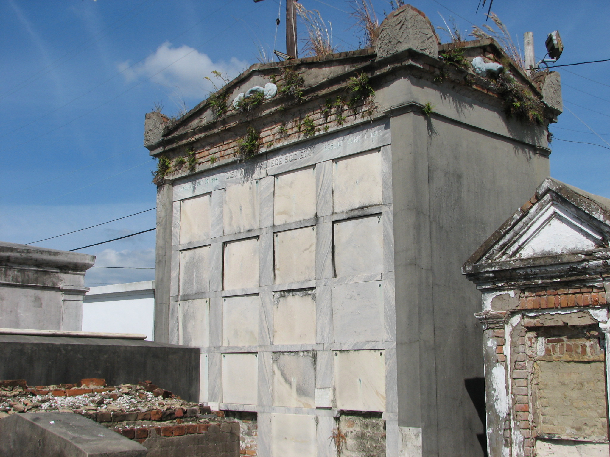
Born on the Belle Chase Plantation down in Plaquemines Parish, Francois Valette and his son Octave owned several warehouses on Algiers Point. A large part of their business came from the Vallette Drydock Company. During the Civil War, Valette feared that the Union Army would seize his docks to make repairs or procure supplies, so he dynamited them, essentially putting an end to his own business.

With the combination of steamboats and trains, Algiers later became an economic powerhouse as it became the chief port for transcontinental trade. According to Chase, by 1900 the point boasted “70 to 75 percent of all freight to and from the east and west coast of the United States! At these yards and docks transfers from freight train to steamship was made; often a whole train’s cargo from the West was loaded aboard ship in twelve hours for the remainder of its journey to an Atlantic seaboard point.” (191). Thus, Algiers has streets named Pacific and Atlantic. However, the Panama Canal would make Algiers Point an obsolete transcontinental port.


Today: Vallette Street is predominantly residential; however, one can find several local businesses and community centers. Arts-focused organizations, like the Rosetree Blown Glass Studio and the Calliope Puppet Center, are located along the street. A testament to the meandering nature of the Mississippi, Vallette Street first runs perpendicular to the river only to parallel it later.


The Rosetree Glass Studio on Vallette Street is housed in the historic Algy Theater built in 1940. Credit: algierspoint.org

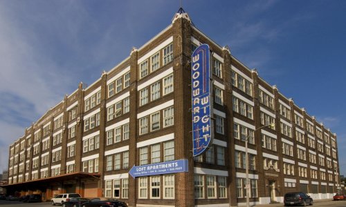
The Rosetree Blown Glass Studio on Vallette Street is housed in the historic Algy Theater built in 1940. Credit: algierspoint.org

Algiers is located on what is known today as the “West Bank,” which refers to the Mississippi River’s geographic location, not its directional position. In other words, if you stand at the point, Uptown New Orleans is technically the western bank. Despite the incessant meandering of Old Man River, the “West Bank” is still the western side.

Algiers identifies with its iconic ferry, which brings commuters (both pedestrian and automotive) to the foot of Canal Street in downtown New Orleans. People can go to Algiers’s historic district for a small town feel. You can go listen to live music at The Old Point Bar or have a pint at the Crown and Anchor English Pub. Anyone with the photography itch should make it a point – ah – to go Algiers, since it boasts some of the best panoramic views of the city. There is also a bike path along the levee which leads to downtown Gretna, a separate town in the Jefferson Parish portion of the West Bank.

Tomorrow: Throughout history, the ferry has made Algiers what it is today, no matter if its ferrying people or commodities; however, this icon’s future is rather unknown at this point. Granted, I don’t think that the ferry will be disbanded (even though that happened a few years ago with the Gretna/Jackson Street Ferry), but it is undergoing a few changes that have residents wondering.

View from the Algiers Ferry. From Algiers Point, one can take in one of the best views of the city.

In 2014, Veolia, a privatized transit company, began operating the ferry. Pedestrians now have to pay $2 per trip whereas they rode gratis before. Also, the operating hours have been reduced. Resident Algerian Ian Graham, who commutes to work at The Prytania Bar in Uptown, says, “The major fear right now is that reduced ferry hours will hurt restaurants, bars, and B&Bs.” He is skeptical about Veolia expanding hours of operation, despite their claims to do so. “Generally, I think people are willing to do whatever it takes to keep the ferries. Veolia says they are about to put advertisements on the boats, like they do on buses. Hopefully that can help pay for maintenance.” Graham feels that the $2 pedestrian charge is not unreasonable; however, the monthly passes do not yield much of a discount and that may affect the residents and working commuters (the people who rely on ferry service the most). The annual Algiers Riverfest was cancelled this summer due to reduced ferry hours, and is still on hiatus.

I’m quite confident that this ferry fiasco will sort its way out. One thing I know and respect about “West Bankers” is that they are truly devoted to their communities, and I don’t see that changing in any regard.


Sources:

John Churchill Chase. Frenchmen, Desire, Good Children.

Liz LeCour. “Francois Azanor Vallette, Sr.” http://www.findagrave.com/cgi-bin/fg.cgi?page=gr&GRid=89877611

Andrea Shaw. “Algiers Riverfest on hiatus; Wednesdays on the Point, hopes for extending ferry hours.” The Times Picayune. May 9, 2014. http://www.nola.com/festivals/index.ssf/2014/05/algiers_riverfest_on_hiatus_we.html

Algiers Point Association: http://www.algierspoint.org

Judi Robertson and Kevin Herridge. Algiers Point Association. http://www.algierspoint.org/historical-tour.html

Friends of the Ferry:  http://www.friendsoftheferry.org/algiers-point.html

http://nolaferries.com/

Calliope Puppet Center: http://artsneworleans.org/events_framed/for_venue/3054


St. Joseph Street

Cobblestones contribute to St. Joseph Street's unique character.

Cobblestones contribute to St. Joseph Street’s unique character.

The Gist: St. Joseph Street in the Warehouse District was named after Marie Josepha Deslonde Gravier. She was the wife of Bertrand Gravier, the Faubourg Ste. Marie suburb developer.  There is no correlation with the famous St. Joseph’s Altar Celebration on March 19th. The St. Joseph Altar tradition was brought to New Orleans by Italian immigrants, and it is both a celebration of lent (seafood and vegetarian dishes) and a way to feed the poor since most of the leftovers are donated to local churches and charity organizations. Interestingly enough, St. Joseph Day is also celebrated by the Mardi Gras Indians on “Super Sunday.”

"Vue d'une Rue du Faubourg Ste. Marie, Nelle. Orleans. (Louisiane)." This lithograph portrays a street scene of teh Faubourg Ste. Marie, which was also named for Marie Josepha Deslonde. The scene starkly contrasts with the present day Central Business District.

“Vue d’une Rue du Faubourg Ste. Marie, Nelle. Orleans. (Louisiane).” This lithograph portrays a street scene of the Faubourg Ste. Marie, which was also named for Marie Josepha Deslonde. The scene starkly contrasts with the present day Central Business District/Warehouse District. Credit: The Historic New Orleans Collection.

Yesterday: To my disbelief, St. Joseph Street has no connection with St. Joseph at all. Several “saint” streets are not named after real saints, and St. Joseph Street is no exception. (check out my previous post about St. Charles Avenue).

Marie Josepha Deslonde inherited the area which would eventually become her namesake. Married to Andre Renard, she received a large tract of land after his death. The land originally was part of a subdivided Jesuit plantation. Chase says, “Bertrand Gravier fell madly in love with Marie and her arpents. They married; then she died and left her seven arpents to Bertrand. On the last day she made the will, historians slyly point out!” (70).

Today: St. Joseph Street is located in (what is now) the Warehouse District in New Orleans. The area was much more industrial in the early 1900s, given the area’s namesake. Though the area does not consist of operational warehouses, St. Joseph Street (as well as much of the Warehouse District) retains many of the original buildings, which have been converted to apartments, museums, or office buildings.

This warehouse was renovated in 1999 and now houses the Contemporary Arts Center on St. Joseph and Camp.

This warehouse was renovated in 1999 and now houses the Contemporary Arts Center on St. Joseph and Camp. Photo Credit: http://www.trimarkconstructors.com

The Woodward Wright warehouse once was a fully operational factory in the early 1900s manufacturing steel tools, equipment, and appliances. It since has been converted to trendy apartments. Photo Credit: www.hriproperties.com

The Woodward Wright warehouse once was a fully operational factory in the early 1900s manufacturing steel tools, equipment, and appliances. It since has been converted to trendy apartments. Photo Credit: http://www.hriproperties.com

Tomorrow:  For a while now, the Warehouse District has been a conglomeration of arts and entertainment, museums, local entrepreneurship, and regional cuisine, while attempting to retain the historical significance of the area.

I haven’t read Richard Campanella’s recent book, Bourbon Street: A History; howeverwhat I see from the map on NOLA.com, New-New Orleanians (or “Neo-Orleanians” if you will) seem to think that this area is “uncool” and “unauthentic.” I disagree 100%. If HBO ever has a new show and calls it The Faubourg Ste. Marie, people would flock there in mass.  In fact, the Warehouse District/CBD is one of my favorite places to go in New Orleans. It’s always seemed much more authentic and local to me than other places in the city despite what anyone says.

And, the “coolness” factor? Really? Has New Orleans become a freaking high school cafeteria? When the hell did that happen?


Sources:

John Chase. Frenchmen, Desire, Good Children. 1949.

The Historic New Orleans Collection. http://www.hnoc.org.

Langenhennig, Susan. “Richard Campanella discusses ‘The Geography of Cool’ on Radio Show.” NOLA.com. March 14, 2014: http://www.nola.com/homegarden/index.ssf/2014/03/richard_campanella_discusses_t.html

http://www.hriproperties/woodward

The Contemporary Arts Center of New Orleans. cacno.org

St. Charles Avenue

The Gist: St. Charles Avenue was named after King Charles III of Spain, who was in power when Spain acquired New Orleans in 1763. It’s not necessarily named after a saint, but the Spanish monarch.

Yesterday: St. Charles Avenue has become one of the most iconic avenues in New Orleans, yet it was nothing more than a swampy frontier in 1822. John Chase writes, “St. Charles street was best known to the boys, who sought in sport for snipe among the latanier in the marshes, which had never been disturbed otherwise in their original growth” (122). He says that eventually St. Charles Avenue would be become the American Sector’s “lifeline.”

The original St. Charles hotel built two blocks from Canal Street in 1837. It was designed by famous architect, James Gallier and was one of the first great American hotels in the country. In 1851, it burned down in one of the city's great fires. It was rebuilt without it's iconic dome. It also would burn down in 1894.

The original St. Charles Hotel built two blocks from Canal Street in 1837. Designed by famous architect James Gallier, it was one of the first great American hotels in the country. In 1851, it burned down in one of the city’s great fires. It was rebuilt without its iconic dome, yet would burn down again in 1894.

It seems that St. Charles Avenue was always bustling with activity and prosperity even since its conception. Drinking was big then as it is today. Chase says that a library owner installed a bar among the bookshelves so that his library could survive. And, it most certainly did after that. Chase says that the avenue “was a gay, bright, and lively street with an air of exciting bohemianism about it” (212).

A railroad connected New Orleans and the town of Carrollton (the former Jefferson Parish seat and now the Riverbend area of Uptown New Orleans), prompting growth along the route. This is how St. Charles Avenue grew across what was once a row of plantations. This railway is still in use today as the St. Charles streetcar line, which is oldest working railway in the world.

A streetcar rolls passed The Holy Name of Jesus Church on Loyola University's campus. Tulane University is adjacent to the church, and the beautiful Audubon Park is across the street.

A streetcar rolls passed The Holy Name of Jesus Church on Loyola University’s campus. Tulane University is adjacent to the church, and the beautiful Audubon Park is across the street.

Today: Just as it was the major avenue for the American sector of the Faubourg Ste. Marie (now the CBD), it remains the primary Uptown route with homes, restaurants and bars, shops, universities, parks, and businesses. On this street, one can really see the diversity of New Orleans. You will see lawyers and businessmen wearing suits alongside service industry workers in chef shirts or serving aprons. People of all races, economic classes, and backgrounds can be seen along St. Charles Avenue.

St. Charles Avenue undergoes a traffic circle at Lee Circle. Named after Confederate General Robert E. Lee, Lee Circle remains a popular destination to catch parades. Notice the row of port-o-lets at the bottom of the picture.

St. Charles Avenue at Lee Circle. Named after Confederate General Robert E. Lee, Lee Circle remains a popular destination to catch parades. Notice the row of port-o-lets at the bottom of the picture.

From Canal Street to Calliope Street (near the Pontchartrain Expressway Overpass), the avenue is full of law firms, skyscrapers, hotels, banks, fine restaurants, and town parks (like Lafayette Square). It then curves all the way to the river, intersecting with Carrollton Avenue in the Riverbend section of Uptown. It passes Tulane and Loyola universities, Audubon Park, and countless bars and restaurants.

The St. Charles streetcar line is still a major mode of transportation for locals and tourists alike. On a nice Spring afternoon, the streetcars will be at capacity with riders enjoying the views of century-old live oaks and elegant homes (some Antebellum). Most American cities refer to these transportation cars as “trollies;” however, we call them “streetcars.” The green streetcar along the St. Charles route has become an iconic symbol of New Orleans. Children commonly have birthday parties aboard them.

Since carnival season is in full swing, it is also good to mention that St. Charles Avenue has become a standard route for most Mardi Gras parades due to its wide neutral ground (or median) that can accommodate large crowds. Though several krewes parade down St. Charles Avenue two weeks before Mardi Gras, the most popular parades lead up to Fat Tuesday. On Thursday night, Muses (a krewe exclusive to women) rolls. Bacchus (one of the few “super krewes”) rolls the Sunday before Mardi Gras and features a famous celebrity as the Grand Marshal each year. Orpheus runs on “Lundi Gras” (or the Monday before Mardi Gras), while the Zulu and Rex parades roll on Fat Tuesday. During carnival season, beads get caught in tree branches and power lines and decorate the avenue until the next carnival.

Clockwise from top left: Mardi Gras beads hanging year round in trees along parade routes; the Bigshot float in the Zulu Parade, seated ladders are a common site along St. Charles during Mardi Gras; the Buoef Gras float in the Rex parade.

Clockwise from top left: Mardi Gras beads hanging year round in trees along parade routes; the Bigshot float in the Zulu Parade; seated ladders are a common site along St. Charles during Mardi Gras; the Boeuf Gras float in the Rex parade. Credit for Boeuf Gras and Zulu pictures: Chris Graythen, Getty Images.

Zulu is a historic African-American parade that runs on the early morning of Fat Tuesday. This krewe was not allowed to parade publicly until 1968. Run by the Social Aid and Pleasure Club, Zulu has both white and black riders that dress in grass skirts and have black face. This event is most likely the only occasion in America (if not the world) when white and black people wear blackface together and it be not only tolerated, but celebrated. As I’ve said before, we do things a little differently down here.

The Krewe of Rex is also a historic parade that first took to the streets in 1872. It brought stability to the carnival season at a time when the city considered eliminating carnival due to chaos and disorder, and they continue to do things for the public good (as their motto “Pro Bono Publico” suggests). Rex’s iconic Boeuf Gras float symbolizes the medieval routes of carnival. Historically, many European (typically French) cultures used to parade cattle down the streets and into the slaughterhouse for one last feast before fasting for Lent. In fact, Rex paraded live cattle in the parade for many years as well. Dr. Stephen Hales from the Rex Organizations says, “The Boeuf Gras is the oldest symbol of carnival, going back to the Middle Ages. In fact, back then they called it Boeuf Gras, not even Mardi Gras. If you took a 14th-century Frenchmen and parachuted him into New Orleans during Mardi Gras, he would be baffled as to what was happening, until he saw the Boeuf Gras float. Then, he would know exactly what was being celebrated.”

Tomorrow: St. Charles Avenue can appear as a time capsule with the streetcars, century-old mansions, and oak trees; however, new developments are always transforming the grand street. According to http://www.nola.curbed.com, a new grocery is being planned at 2025 St. Charles Avenue and will supposedly have a “beer cave,” coffee station, and a walk-in cigar humidor. These are a few of my favorite things, it just so happens.

As far the future of St. Charles Avenue goes, I do not foresee any significant changes, and I think mostly every New Orleanian is 100% content with that as well.

Am I wrong?

Sources:

John Chase. Frenchmen, Desire, and Good Children. 1949.

Sarah Chase. “New LGD Grocery Will Have a Walk-in Humidor and ‘Beer Cave.’” http://www.nola.curbed.com. 15 January 2014.

http://www.rexorganization.com

http://www.old-new-orleans.com/NO_StCharlesHotel.html

St. Louis Cemetery #1

Image

Getting into the Halloween spirit, I decided to change the blog this week. I initially thought to do a brief profile of each New Orleans cemetery, but that would have been quite an undertaking since there are over 14 historic cemeteries, each of which deserves more than one small paragraph. So, the obvious choice was to choose the St. Louis Cemetery #1, New Orleans’s oldest extant (or still-in-use) cemetery. Above is a painting I did for the Save Our Cemeteries art contest in 2000.

The Place

The aboveground tombs from St. Louis Cemetery #1 blend in well to the New Orleans skyline.

The above-ground tombs from St. Louis Cemetery #1 blend in well to the New Orleans skyline.

The cemetery’s site was designated by the Spanish Crown in 1789 in order to not only make room for more corpses but also to distance the citizens from potential disease outbreaks. At this time, (what is now) Basin Street was low swampland beyond the city limits.  The traditional “above-ground” tomb became popular because it helped maximize space (multiple people or whole families could be buried in one tomb). It also proved better than burying people underground since the mud was saturated, and the Mississippi River frequently flooded its natural banks. Now that modern technology can pump water from New Orleans, underground burials are possible; however, above-ground burials are a tradition. [Saveourcemeteries.org]

The flat tombs are a stark contrast to the aboveground tombs in the "Catholic" section.

The flat tombs are a stark contrast to the above-ground tombs in the “Catholic” section.

A small Protestant section exists in the back of the cemetery, whereas most of the grounds are designated as Catholic burials. It is ironic that such hallowed ground would eventually be next door to Storyville, the infamous red-light district, which was closed down by the Navy during World War I out of fear that it might distract the sailors from their duty. It was later demolished in the 1930s. The Iberville housing projects are now adjacent to the cemetery in its place.

The People

Just like today, a diverse population resided in New Orleans back then.

Here lies Bernard de Marigny. Custom has it that vistors leave dice on his tomb to commemorate his destructive love for the game of craps.

Here lies Bernard de Marigny. Custom has it that visitors leave dice on his tomb to commemorate his destructive love for playing craps.

Bernard de Marigny: The name should sound familiar to many New Orleanians since the trendy “Marigny” neighborhood was once his former plantation. He also founded the city of Mandeville and established a sugar plantation on the North Shore of Lake Pontchartrain where Fontainbleau State Park exists today. He was highly influential in the development of the city of New Orleans and the state of Louisiana. Also, he was a degenerate gambler who lost most of his lavish fortune. Supposedly, he introduced New Orleans to “craps.” Robert Florence says, “He ended up destitute and terribly in debt … and at 53 had to go to work as a clerk in the Office of Mortgages and Conveyances after having been not only a business tycoon but also a senator who helped frame the state constitution” [42].

Even though tourists make wishes, give objects, and mark "XXX" as some kind of voodoo ritual, it is still uncertain whether Marie Laveau is buried there.

The Glapion Family Tomb. Even though tourists make wishes, give objects, and mark “XXX” as some kind of voodoo ritual, it is still uncertain whether Marie Laveau is even buried there.

Marie Laveau: The legendary Voodoo priestess is supposedly buried here. Ironically, Laveau was also a devoted Catholic and attended mass daily. It was her mixture of Catholic tradition and Voodoo practice (or “gris gris”) that made her so prominent.  She was born to a wealthy French planter, Charles Laveau, probably due to the “Code Noir” that decreed that a white man must marry a slave if they birthed a child together.  Laveau married two men in her life. Her last husband was Christopher Glapion, a captain in the Battle of New Orleans. His family still owns the tomb, and they do not approve of the droves of tourists that mark X’s on the tomb.  Florence says it’s more “vandalism” than “voodoo” to them. Although it is possibly the most popular tomb in St. Louis #1, it is not quite certain if her actual remains rest there. Florence says, “The date of death, 1897, is not hers, but closer to her daughter’s, Marie Laveau II. So the question is, which one of them is buried here?”


Here lies Homer Plessy. His plan to challenge a state segregation law backfired when the U.S. Supreme Court ruled against him in Plessy vs. Ferguson.

Here lies Homer Plessy. His plan to challenge a state segregation law backfired when the U.S. Supreme Court ruled against him in Plessy vs. Ferguson.

Homer Plessy: He was the Rosa Parks of his time, except it all blew up in his face (along with every other black person living in America at the end of the 19th Century). Plessy and the “Comite des Citoyens” challenged a Louisiana law that segregated passenger trains. Only 1/8 black, he was legally recognized as a “Negro” and was arrested after boarding the white car. Six years later, Plessy vs. Ferguson went before the U.S. Supreme Court, and the court ruled against Plessy, establishing the “separate-but-equal” doctrine for more than 6 decades.


Here lies Paul Morphy. Child prodigy and chess master. Chess players commonly leave chess pieces on his tomb as a sign of respect.

Here lies Paul Morphy. Child prodigy and chess master. Chess players commonly leave chess pieces on his tomb as a sign of respect.


Paul Morphy: Morphy was the best chess player that the world had every seen. Oliver Wendell Holmes said that he was “a triumph of the American intellect.” As a child he was defeating Union generals and world champions. After easily defeating the best chess players around the globe, he decided to call it quits at the early age of 22.  During the Civil War, he and his family evaded the Union occupation of New Orleans by fleeing to Paris, where he would slowly go insane.


The elaborate Italian Society tomb has made popular when the movie Easy Rider featured during the acid trip scene. As a result of that, filming was banned there for many years.

The elaborate Italian Society tomb was made popular when the movie Easy Rider featured it during the acid trip scene. As a result, filming was banned at the cemetery for many years.

There are several “benevolent society” tombs in the cemetery. Such societies were formed to support immigrants. There are society tombs from cultures such as Portugal, Spain, France, China, and Italy.

Dieu Nous Protege Society Tomb; a society for free people of color.

Dieu Nous Protege Society Tomb; a society for free people of color.

Overall, the St. Louis #1 is quite pleasant and intriguing within the confines of its walls. What is a little creepy, however, is how many graves no longer remain in the cemetery. The iconic “Varney” tomb, with its pyramid shape and ball top, greets visitors at the main entrance, yet it once was the half-way point of the cemetery. So, you can assume that you might be walking over corpses when you cross Basin Street and its neutral ground. Actually, many cemeteries are smaller than their original sites (such as Greenwood Cemetery along Canal Boulevard). In fact, St. Peter Street in the French Quarter was one of the original cemeteries of the city. With the development of condos and hotels, construction workers have unearthed skeletons as late as 2011.

This memorial honors the fallen veterans of the Battle of New Orleans. There is also a society tomb in the Catholic section for veterans of this war.

This memorial honors the fallen veterans of the Battle of New Orleans. There is also a society tomb in the Catholic section for veterans of this war.

Each cemetery in New Orleans tells countless stories, including the expansion of the city. Typically, cemeteries marked the outskirts of the current development. Florence says, “To track the growth of the New Orleans, one must start at the river. The story of New Orleans burial begins here as well, on the natural levee.”

Only in New Orleans where “death” can be synonymous with “growth.”  Happy Halloween!

Old tombs easily fall into disrepair or neglect. Organizations, like Save Our Cemeteries, do a great civic duty to the city in helping restore and preserve our history.

Old tombs easily fall into disrepair or neglect. Organizations, like Save Our Cemeteries, do a great civic duty to the city in helping restore and preserve historic tombs.

Sources

City of the Dead: A Journey Through St. Louis Cemetery #1. Robert Florence. 1928.

http://www.saveourcemeteries.org/st-louis-cemetery-no-1/

“15 Coffins Unearthed When Property Owner Digs for Pool on Edge of the French Quarter.” John Pope. Nola.com. http://www.nola.com/business/index.ssf/2011/11/15_coffins_unearthed_when_prop.html

Esplanade Avenue


The neutral ground is rather large near the river, whereas it is narrow as you near Bayou St. John.

The neutral ground is much larger starting at the river, but it becomes a narrow strip of monkey grass at N. Miro Street near the Gayarre Place statue.

The Gist:  Esplanade Avenue gets its name from a Spanish military esplanade that ran from Fort St. Charles (where the U.S. Mint building is today) to Fort St. John (which used to be at the intersection of Barracks and Rampart).

Yesterday: Like most things New Orleans, it’s not a simple story. As most American stories begin, it starts with the Native Americans. What we know now as the “Esplanade Ridge” is a naturally high ground that the Indians used for portage between the Mississippi River and Lake Pontchartrain via Bayou St. John. Once John Law’s Company of the West planned the layout of New Orleans, this area was mandated that it be left undeveloped to allow for common defense of the new town. During the French colonial period, this area became later known as the “City Commons,” which was a plantation that was commonly owned and operated by five different owners. So, it did not go over well with the landowners when the Spanish came to power and decreed that the land be used directly for defense and built Fort St. Charles at the river and Fort St. John at (what is today) the intersection of Barracks and Rampart. They sued the Spanish King to no avail. By 1803, when the Louisiana Purchase commenced, the Spanish fortifications had fallen into disrepair. Since the area originally belonged to the French, the U.S. reasoned that the land was now theirs. Fort St. Charles had some influence leading up to the Battle of New Orleans, but the city did away with it by 1821.  The U.S. Congress than decreed that the old “City Commons” be divided up into new subdivisions to allow for expansion. The descendants of the “Creole” people of New Orleans expanded out from the French Quarter, since the American Sector was beyond Canal Street. It later became an avenue of great architecture and wealth, very similar to the American St. Charles Avenue. Several Catholic schools, such as St. Aloysius (which later merged with Cor Jesu to form Brother Martin in Gentilly), were established along the “Promenade Publique” as it was commonly called.

Of course, the story doesn’t end there. The U.S. Mint building would then take the place of Fort St. Charles; therefore, the city would give that building to the federal government. Ironically, Major P.G.T. Beauregard, who would later side with the Confederacy and command the forces at Fort Sumter, suggested extensive repairs be made to both stabilize and “fire proof” the building (Christovich 15). Once the Civil War broke, the city then seized the mint back from the federal government. Once General Farragut captured New Orleans, General Ben Butler occupied it, and the union seized the mint back from the city. As time went on, Esplanade Avenue would soon have a rail-line connecting the river to Bayou St. John, so residents could travel to the “pleasure gardens […] on sites of early plantations at the bayou” (Christovich xix). The elegance and atmosphere of this street would attract several artists including French Impressionist Edgar Degas.


This area was an old Indian Market. Several other triangular parks adorn Esplanade Avenue.

Esplanade splits left and Bayou Road splits right just after N. Miro Street. Gayarre’ Place was once near an old Indian Market. Several other triangular parks are along Esplanade Avenue as a result of centuries of boundary line disputes.


Today: Esplanade Avenue runs from the Mississippi River and ends at Bayou St. John. It borders unique neighborhoods such as the Vieux Carre, the Fauborg Marigny, and the Treme. It has something for everyone. Lavish homes, museums, quaint B & Bs, music venues, horse races, festivals, dive bars, coffee shops, green space, cemeteries, and dining establishments. The U.S. Mint building is now a Louisiana State Museum and its grounds host several musical festivals such as Satchmo Summer Fest and the Cajun-Zydeco Music Festival. Esplanade is the entrance to the booming music scene on Frenchmen Street in the Marigny. Every spring, the Crescent City Classic route follows most of Esplanade into City Park, and over 20,000 runners gaze at its unique features as they run by. The Degas House is a B & B that has been restored to honor the artist’s and the neighborhood’s history. Just a few blocks off the main street, the historic Fair Grounds Race Course run horses from Thanksgiving to March and host the immensely popular New Orleans Jazz and Heritage Festival that kicks off the last weekend in April and ends the first weekend in May.

Esplanade crosses Bayou St. John and ends at a small traffic circle on Wisner Boulevard, which soon turns into North Carrollton (going towards the river). The circle revolves around a statue of General P.G.T. Beauregard who once lived on the avenue and would later promote the Louisiana Lottery. Where the attractive gardens once were beyond the bayou, City Park gives residents the opportunity to have picnics, play sports, and bicycle among many other activities. The New Orleans Museum of Art is one of the grand views from the foot of Esplanade Avenue. Although a rail line no longer runs the length of the avenue, the City Park line (a part of the Canal Streetcar line) ends at the park, so residents can still access Esplanade and the bayou.


Cresson House (built around 1902). Several houses along Esplanade Avenue are unique.

Cresson House (built around 1902). Several houses along Esplanade Avenue are unique.

Tomorrow: Also, like most things New Orleans, the story isn’t over. In the book, New Orleans Architecture: The Esplanade Ridge, Christovich writes that Esplanade Avenue “is beautiful, it is grand, it is shabby and often frayed; it is struggling for new definition and survival” (xx). The eclectic avenue is all of those things and continuing to redefine itself. Paths to Progress, an intergovernmental partnership, is resurfacing many streets throughout New Orleans. The construction has ended on Esplanade, making the portion between the bayou and Claiborne Avenue one lane traffic to allow more parking area and a bike lane. Wheelchair curbs were also installed. Some residents have complained about the inconvenience of the construction and remain skeptical of the new development. Many believe that the one lane traffic will cause gridlock traffic, especially during Jazz Fest. That remains to be seen, of course, next year. The American Heritage Dictionary defines “esplanade” as being “a flat, open stretch of pavement or grass used as a promenade.” And, just as it originally began as a public space, New Orleanians still can enjoy Esplanade Avenue via foot, bike, or automobile.


Primary Source:  New Orleans Architecture: The Esplanade Ridge. Mary Louise Christovich, Sally Kittredge Evans, and Roulhac Toledano.

General Pershing Street

Image

General John Pershing

The Gist:  General Pershing was the most celebrated and revered U.S. general in World War I. It was later decided that Berlin Street be renamed for him during the war.

Yesterday

This street was not originally named General Pershing considering it was part of a subdivision that predates the Great War by about 80 years.  At this time, what we call the “Riverbend” part of Uptown was simply Carrollton, a separate township that was established in 1833. Carrollton developers, Laurent Millaudon and Samuel Kohn, sought to divide up part of the Bouligny Plantation since it would be on the stopping point of an upcoming railroad line, halfway to Carrollton.  They wanted to be the first to jump on what could become prime real estate. At this point in time, there was a resurgence of French interest or, as John Chase calls it, the “French craze.” The developers used this as a marketing strategy, essentially. Hence, the original street was called Berlin Street in honor of Napoleon’s victory over the Prussians.

Today

General Pershing Street is what we Americans call it today, and it remains to be prime real estate. Just as the “French craze” honored the French emperor, the anti-German craze of World War I sought to rename Berlin Street for the American war hero, John “Black Jack” Pershing, as a result of “confused flushes of patriotism” (Chase 147). World War I history is not typically America’s strong subject, so I’ll put it like this: the American Revolution had George Washington, the Civil War had U.S. Grant and Robert E. Lee, and World War II had Dwight D. Eisenhower. Well, World War I had John Pershing.  In fact, he could be regarded as the primary mentor for men like Eisenhower, McArthur, and Patton. Pershing got his nickname “Black Jack” because he led African-American troops who became known as the original “Buffalo Soldiers” in the Spanish-American War. In response to Pancho Villa’s raids, Pershing commanded the forces that invaded Mexico in pursuit of the elusive Villa.  And then, of course, the First World War immortalized him.

The street itself is mostly within the Uptown region of New Orleans and remains predominantly, if not all, residential. It stretches from the Mississippi River, paralleling Napoleon Avenue, to the Broadmoor area.  Beyond Broad Street, General Pershing Street slingshots to the left (if you are going towards the lake) and parallels Fountainebleau Drive for a few blocks.

Image

Bilingue de la Nouvelle-Orléans French Immersion School (left); St. Henry’s Catholic Church (right).

Tomorrow

Near General Pershing and Magazine, Ecole Bilingue de la Nouvelle-Orléans, a French immersion school, promotes multilingual development in children. The French language was once dominant in New Orleans, but many New Orleanians have forfeited their mother tongue for English over the last century. The French/Spanish “creoles” are rolling over in their watery graves for sure. However, maybe this school can help restore the French language to the area.

It is also worth noting the complex relationship between the Germans and New Orleans. Past residents insisted that they rename Berlin Street in order to dishonor the Germans during the war. But, the Germans had an enormous influence of the Louisiana colony that New Orleanians will never give them credit for.  Perhaps, that’s just the result of growing up in a post WWI and WWII America. One example, the Germans perfected “French bread” as we know it, and the name Leidenheimer is blatantly not French.  There’s much more to the Germans’ story, and I’ll go more into that in later posts.  But, perhaps we can learn about the other European cultures that made the city what it is, instead of blindly giving credit to the French, who (other than founding the colony on a basis of lies) did less than other Europeans (especially the Spanish and the Germans) to establish and develop New Orleans.

Canal Street

Canal Street

Canal Street

The Gist: Canal Street was named after a navigational canal that never actually came to fruition. It was also the original “neutral ground,” which is what New Orleanians call street medians.

Yesterday
Contrary to common belief, Canal Street was never a major navigation canal that was later filled in. There was once a stagnant ditch near there, which gave city developers the idea. Congress designated the wide area for a canal in 1807, but the Orleans Navigation Company basically screwed the pooch. As a street, it separated the “Creoles” from the vile Americans but yet provided a neutral area for commerce between the two clashing cultures. Many store employees were commonly bilingual. It would become home to America’s first movie theater in 1896 as well as department stores such as D.H. Holmes. Canal Street has been a common setting in literary works by authors such as George Washington Cable, John Kennedy Toole, Kate Chopin, and Walker Percy.

Today
Canal Street now runs from the Mississippi River to the Mid-city cemeteries. Towards the river, the street continues to be a retail hub for New Orleans and still separates two distinct worlds: the French Quarter and the Central Business District. On one side, historic brick buildings display ironwork balconies and Spanish architecture, whereas the CBD contains modern office buildings and skyscrapers. The traffic is typically congested due to construction work, buses, tourists, streetcars, and poorly-timed streetlights. Near the I-10 overpass, the street still suffers from blight due to Hurricane Katrina and the bad economy. The Joy Theatre and the Saegner Theatre have reopened since the storm. Streetcar tracks run inside the “neutral ground” of Canal Street. Ironically, the tracks were dismantled in the mid-20th century in an attempt to modernize the city with bus lanes. In 2004, the line was restored once the City of New Orleans realized they screwed the pooch on that one. Towards the lake, Canal Street is mainly residential with several local businesses, schools, bars, and restaurants. This part of Canal Street severely flooded during Katrina, yet many parts have rebuilt since then.

Tomorrow
The upcoming massive medical district, which includes the new VA hospital and University hospital, has the potential not only to provide residents with medical options and employment opportunities but also to boost the city’s economy and create a viable industry for the future.

N.O. Street Smarts

papa joesI’ve always been interested in how New Orleans got some of its street names. New Orleans history is also one of my passions, so I felt I should start looking into it and sharing it with other New Orleanians.

Do you know who Claiborne was? How did Canal Street get its name? I certainly asked myself these types of questions long enough. I’m ready to start looking for some answers. Given the eclectic street names in this town, I shouldn’t run out of material any time soon.